

Tamalpais – támal pájiṣ – “west hill”
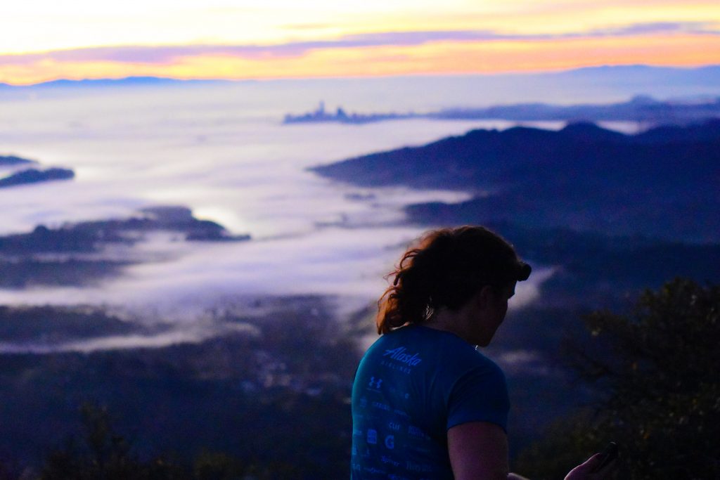
This one’s been a long time coming. Such a pleasure for us to bring the Tribe to the top of Mount Tamalpais this morning, with many of us cresting East Peak for the first time. After yesterday’s annual celebration of gratitude, we all need to remember how fortunate we are that the older generations had the foresight to preserve these public lands for preservation of many native plants and animal species, for our enjoyment, and for giving us a platform to remove ourselves from the cities, to #optoutside and embrace our outdoors. The majority of the mountain is contained in protected public lands, including Mount Tamalpais State Park, Muir Woods National Monument, and the Mount Tamalpais Watershed. It adjoins the Golden Gate National Recreation Area (which in turn adjoins Point Reyes National Seashore) as well as several Marin County Open Space Preserves. This provides nearly 40 miles of continuous publicly accessible open space. It’s a pretty spectacular backyard we have! P.S. Help out your parks. Sign up for our volunteer trail restoration in the Presidio on Saturday December 9th (Fill out the sign up doc).
This mountain has such an amazing history and biological diversity. Many cultures called the Marin Headlands and Mount Tamalpais home, from the Miwok Indians to the military to sporting visionaries and everything in between. For thousands of years, the native Coastal Miwok tribes hunted small animals and deer, collected acorns, and gathered flora, marsh plants and shellfish amongst the lakes and watersheds of present day Marin County. These coastal Indian tribes called Tamalpais home for 5,000 years, and it was so sacred to the Miwok that they would not climb to the summit. Coyote, their name for the god who created man, resided at its peak. It’s exciting and daunting to see the other creatures that share these trails with us. I’ve only had run-ins with bobcats, turkeys and deer… but waiting to see that mountain lion: https://thesixfifty.com/feral-photography-amazing-animal-imagery-from-silicon-valley-trail-cams-b02a37ffe09d

Bobcat in Point Reyes
A bit more from the history books. Residents of San Francisco, whose population exploded after the 1848 gold discovery, used Mount Tamalpais for recreational purposes. Trails were developed, and a wagon road was built to the top of the mountain in 1884. The Mount Tamalpais Scenic Railway, completed in 1896, carried visitors to the mountaintop and the Summit Tavern, a hotel and restaurant. This ran all along the Old Railroad Grade fireroad, which we crossed on our hike today between Hogsback and Fern Creek. The slope from Mill Valley to the summit was so steep that the railroad had to negotiate 281 curves, equivalent to 42 complete circles, billing itself as the “Crookedest Railroad in the World.”
We mentioned that the West Peak is an underappreciated summit. The less-traversed West Peak is actually Tam’s original summit (2576ft versus East Peak’s 2572ft), and supposedly still receives less than 1 percent of the 3 million annual visitors to Mount Tam. One crazy story about the West Peak is that it used to actually be 30 or 40 ft taller. In the 1950s, the West Peak was bulldozed by the U.S. Army Corps of Engineers to build an Air Force station as the Cold War heated up; thousands of tonnes of rock was shoved away. Until 1980, the site was used to search for Soviet war planes (there are supposedly two downed WW2 planes off trails in around Tam, but I’ve still yet to find them) and housed short-range Nike nuclear missiles to gird against an attack that never came. The base closed in 1980, but left behind was a 106-acre scarred site that hosts crumbling structures, building foundations, pipes, power lines and a network of roads. Thankfully, there’s been a lot of fundraising efforts over the past decade to restore the original look of the peak. With spectacular panoramic views of the mountain, it’s definitely worth the quarter mile hike in off of Ridgecrest Boulevard above Pantoll. In the meantime, check this documentary out to find out more about the Invisible Peak…
Invisible Peak (Hidden in plan sight)
West Peak is also home to the Mountain Theatre (also known as Cushing Memorial Theater). This huge outdoor amphitheater accommodates 3,750 people and is the site of the Mountain Play each Summer. In 2018, we’ll have “Mamma Mia” played throughout May and June, so check that shit out (http://mountainplay.org/). The theatre also used to host the Tam Jam festival. Fingers crossed that one comes back!

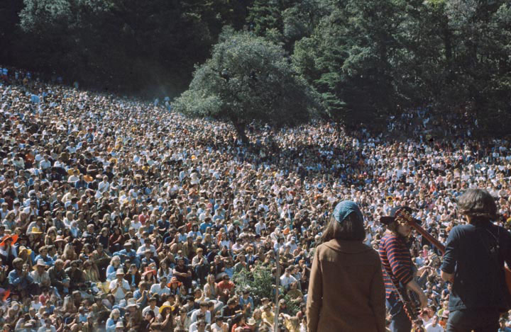
Jefferson Airplane @ Fantasy Fair & Magic Mountain Music Festival 1967 Mountain Theater, Mount Tamalpais
It also holds a special places in the history of endurance and adventure sports. Considering the birthplace of modern mountain biking, it’s pretty awesome to see how the trail network we use as runners codeveloped along with a sport itself. Mt. Tam’s perfect combination of accessible fire roads, views and terrain is ideal for the sport…
For running, Tam’s claim to fame is the venerable Dipsea trail race. The longest running trail race in the United States (and maybe the world), and the first Dipsea was held way back in November 19, 1905. Every June, 1500 runners take on this single track 7 mile route from Mill Valley to Stinson Beach. It’s uniqueness includes its handicapped start, with the oldest runners (80 years plus) starting first with the open age adults starting 30 minutes later, and everyone else in between. It’s a pretty difficult race to get into, so get your application in this year (http://www.dipsea.org/howtoenter.php). AJ Kallet, a regular attendee at Alta Plaza Wednesdays, is a stalwart for the Dipsea races (Single, Double and Quad finisher) so make sure to ask him about the Dipsea (and how to get in!) one of these days on the AP stairs.
The trail running community have a huge place in our hearts for another route on the mountain, the Mount Tam Hill Climb, 3.2 miles and 2500 feet of road, single track and rock scrambling/bush whacking from downtown Mill Valley to the door at the East Peak lookout. Every Labor Day Monday, there’s a race up this route. Also a common training route for the ultra peeps at weekends and Bryan, Melanie & Co. on a Tuesday morning. Another interesting fact, the record for the most Mt Tam summits (i.e. climb from near sea level to the the East Peak from any side) is 5 in one day and 132 over one calendar year. A good buddy of NPSF and Fort Mason fly-byer (though he needs to attend a workout more often), Fernando de Samaniego Steta, tagged both of these records. Think about it. 132 summits = 330000 feet = 62 miles of vertical = 11 Mount Everests from sealevel to Summit. JAYSUS! Absurd! Anyone going for that one next year??
Fun little video on Mount Tam and the SFRC running community
OK enough rambling from me. Hope you enjoyed this little history lesson of our mountain, watch some of the videos, spread the good word and share a nugget of information you learned about our mountain this morning. Wait ’til we do a Mount Diablo workout sometime! Extra 1000ft of vert! East Bay Gang, what’s up!!!
Share via socials:


